|
My small contribution to mountain bike riding around the Wood River (and Stanley) valleys. These are not
full, detailed descriptions, just short bits to give you an idea of some of the rides I really like. I strongly recommend a proper guidebook
( Mountain Biking Sun Valley by Greg McRoberts is my preferred book, you can pick it up at Backwoods Mountain Sports
or online at Amazon.com).
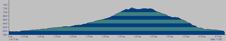
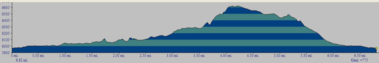
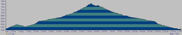
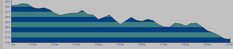
Short but tough, popular ride just north of Ketchum. You'll see lots of people on this trail, for good reason. Only 6.75 miles long (if you descend on Porkchop), it climbs 1,280' to its peak in 3.8 miles (distances from the trailhead, riding clockwise). Excellent views on the way down. For an alternate climb or descent, check out Harper's.
To reach the trailhead:
- » Take Highway 75 north for 2 miles from the Main St / Sun Valley Road stoplight in Ketchum.
- » Turn West on Adam's Gulch road, continue 1/2 mile then turn left.
- » Drive another 3/4 mile to the trailhead.
To ride clockwise:
- » Head west on the dirt road on the valley floor, crossing the creek a few times.
- » At 2 miles, the trail forks with a rough two track going to the left up Eve's Gulch, and single track heading off to the right... take the right trail.
- » At about 2.4 miles, the trail turns north (right) and starts to climb... and climb... and climb.
- » At 3.5 miles top out and enjoy the views.
- » At mile 4.7 you'll reach an intersection... take the left fork to ride Harper's as your downhill back to the Adam's Gulch parking lot, or continue to the right (as shown here) to ride "Porkchop" to the parking lot.
- » Use caution on the downhill as it is steep and there are hikers.
- » When you merge onto Lane's Trail take the hard left (don't go straight across the bridge in front of you) and head back to the trailhead.
All grins downhill if you ride the chairlifts up, or a substantial out and back if you do the climb. This well used ride (with tourists and locals alike) is part of the lift served trail system Sun Valley Company created. Mileage is one way from the top of the chair lift to the parking lot at St. Luke's Wood River... if you didn't leave a car at St. Luke's it's another ~2 miles on the bike path back to the River Run parking lot, or ~5 miles by bike path back to the base of Warm Springs. Summer trail maps are available at both bases and make navigating easy. Not quite as steep, it seems, as its cousin Warm Springs trail on the other side of the mountain.
To ride clockwise from top of the chairlifts:
- » Take the Broadway Trail 1.75 miles to the saddle below the Seattle Ridge Lodge.
- » Head WSW to the 2.35 mile mark where the trail splits right and left.
- » Take the LEFT hand trail (heading back to the east) and enjoy the ride down.
- » At about mile 7.6 the single track ends at the bottom of the Cold Springs chairlift (not running in summer). Head east on the dirt road down through some Sun Valley Company property, ending up at the north end of the parking lot at St. Luke's Hospital.
Mellow warm-up climb earns you a fun, rolly downhill through the trees. Close to town, great for after work or as a quick ride... remember to pick the bugs out of your smile when you're done. We ride this one clockwise, going up the paved road and then out Corral Creek road and doing the singletrack downhill... BUT lots of people go out and back on the singletrack so expect uphill traffic on the singletrack.
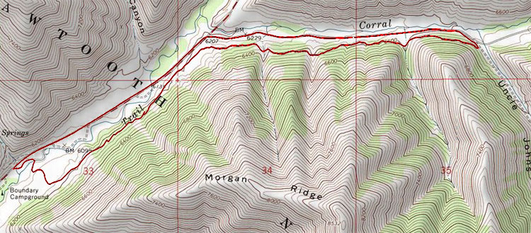
To reach the trailhead:
- » Take Sun Valley Road 3.6 miles north east (through Sun Valley) to the trailhead at the Boundary Campground.
To ride clockwise:
- » Head north east on Trail Creek Road 1.3 miles then turn right (east) onto Corral Creek Road.
- » At 2.85 miles, turn off Corral Creek Road at Uncle John's Gulch... you'll see the corrals here that the road is named after.
- » Turn almost 180° and head west on the singletrack, climbing up into the trees, and enjoy some great up and down cross country riding.
- » At 5.9 miles turn right and head across the bench, sidehill down to the creek bed and cross the creek on the bridge.
- » Turn left after crossing the bridge and ride the short distance back to the trailhead.
- » At the 5.9 mile turn you can go straight and ride a bit more of the bench, but you'll still loop back to the same bridge to get back to the trailhead.
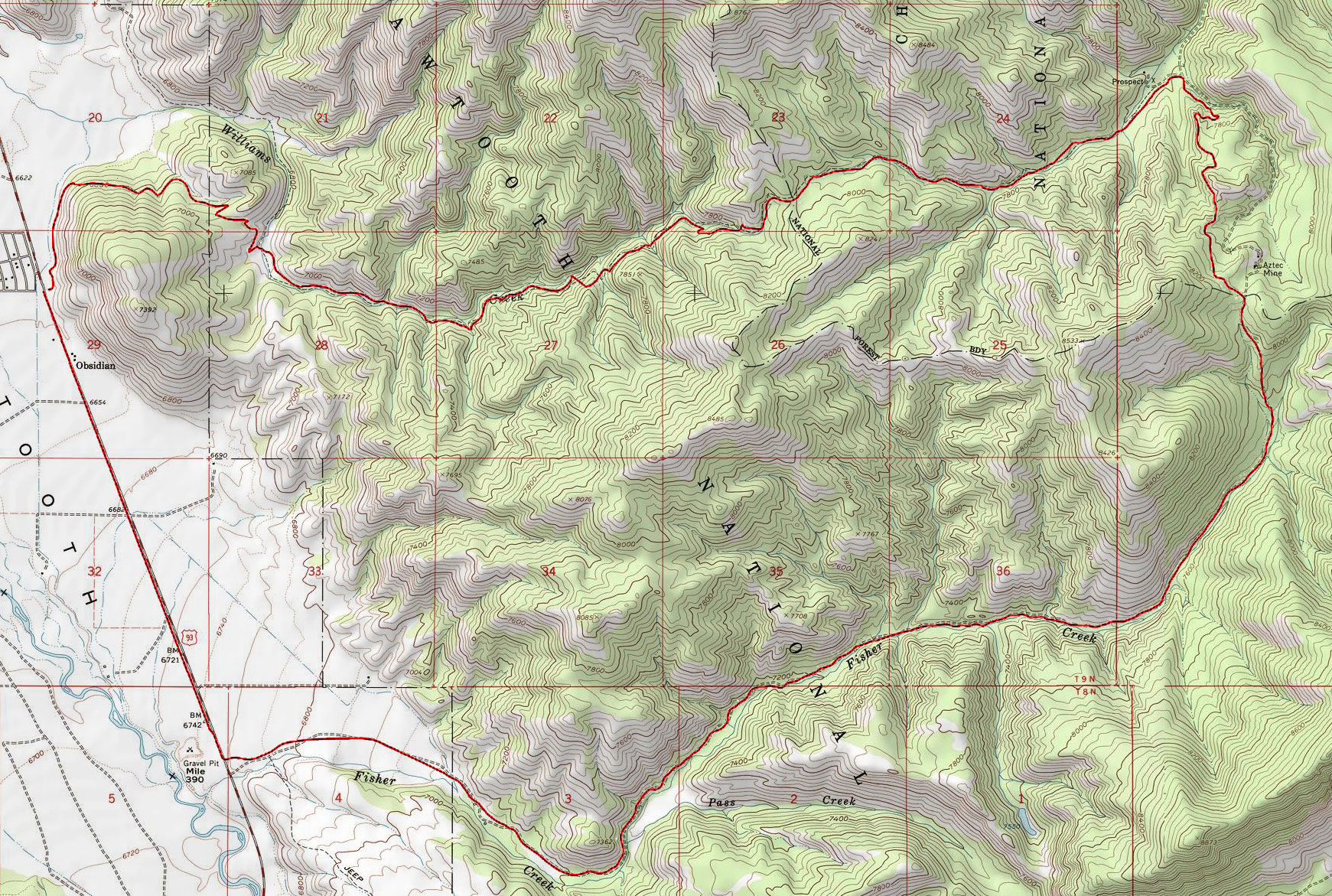
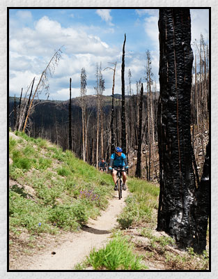
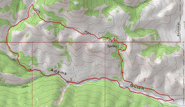
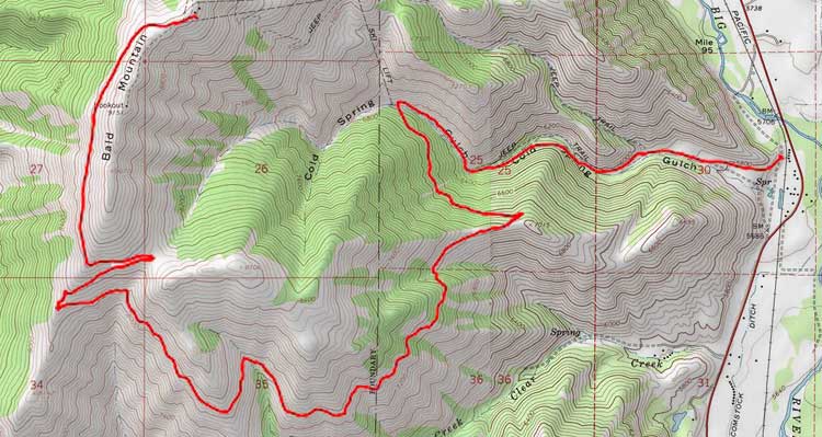
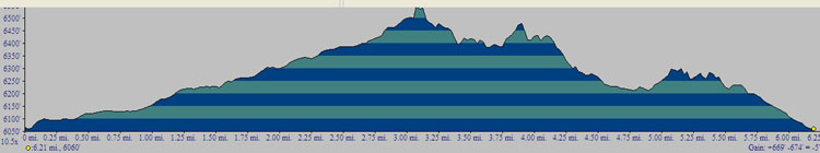
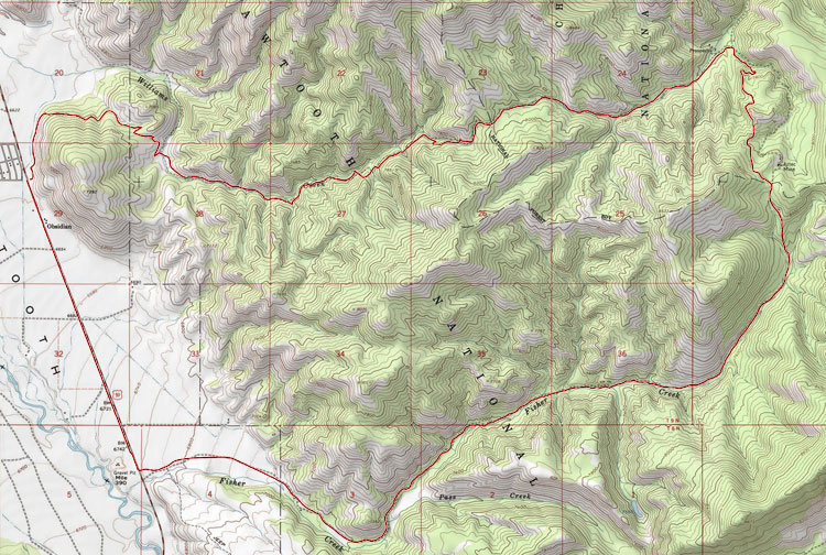
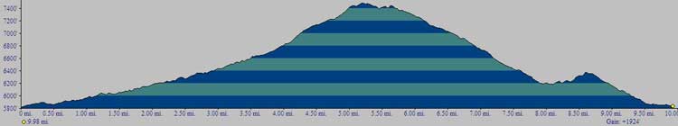
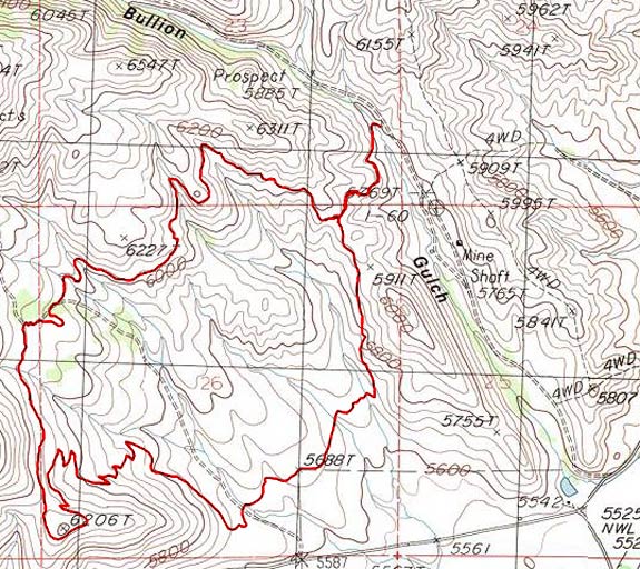
Perhaps the ultimate ride in the area! Great scenery, beautiful trail conditions, long fun rideable downhills,
some cool post-Valley Road Fire terrain, and of course, the wall. Counter-clockwise ride does all your climbing on two tracks and gives you the
great views and singletrack on the downhill.
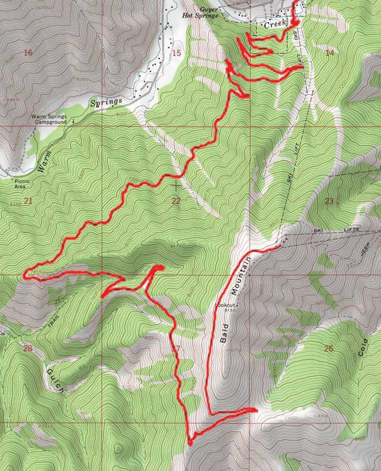
 Click here or on map above for larger map.
To reach the trailhead:
- » Take Highway 75 50 miles north from Ketchum to the William's Creek trailhead, a few hundred yards north of the old Session's Lodge in the "town" of Obsidian, about 20 miles south of Stanley.
To ride counter-clockwise:
- » From the William's Creek trailhead, (carefully) ride Highway 75 2.1 miles south and turn left (east) onto Fisher Creek road (a dirt road).
- » Ride Fisher Creek road for the next 6.25 miles, up through the aftermath of the Valley Road Fire in 2006.
- » At ~8.35 miles you'll hit the Wall (literally and perhaps figuratively). It can be ridden, I've seen it done, but not by me!
- » Top out at mile 8.9, ~8,100' above sea level and catch your breath. Don't follow the two track through the gate into Pigtail, turn left
(northwest) and go through the gap in the fence and onto singletrack.
- » At mile 10.3, turn left (west) towards William's Creek... do not head right (north / northeast) towards Warm Spring's,
not if you want to make it back to Lefty's
before closing time.
- » Time to enjoy what you've worked for... roller coaster downhill on nice smooth singletrack. Take time to stop near the end
and enjoy the views of the Sawtooths across the valley.
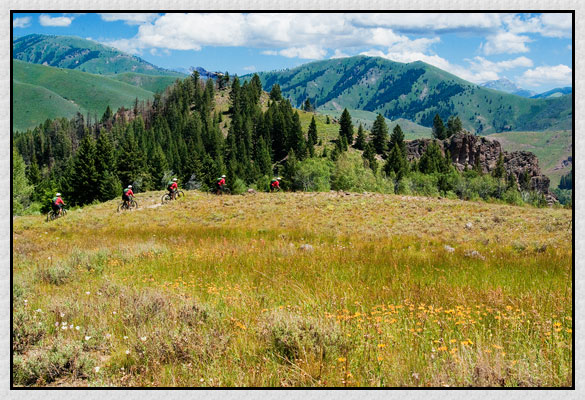
Beautiful, close to Ketchum, great singletrack, good climbing, fun downhill, awesome wildflowers, hard to ask for much else! This ride can be ridden many different ways and connected with a lot of other rides (Oregon Gulch, Adam's Gulch, Chocolate Gulch)... description below is for riding just the Fox Creek loop from the Lake Creek trailhead. This ride is done counter-clockwise, which is actually the rule not just a guideline for this trail.
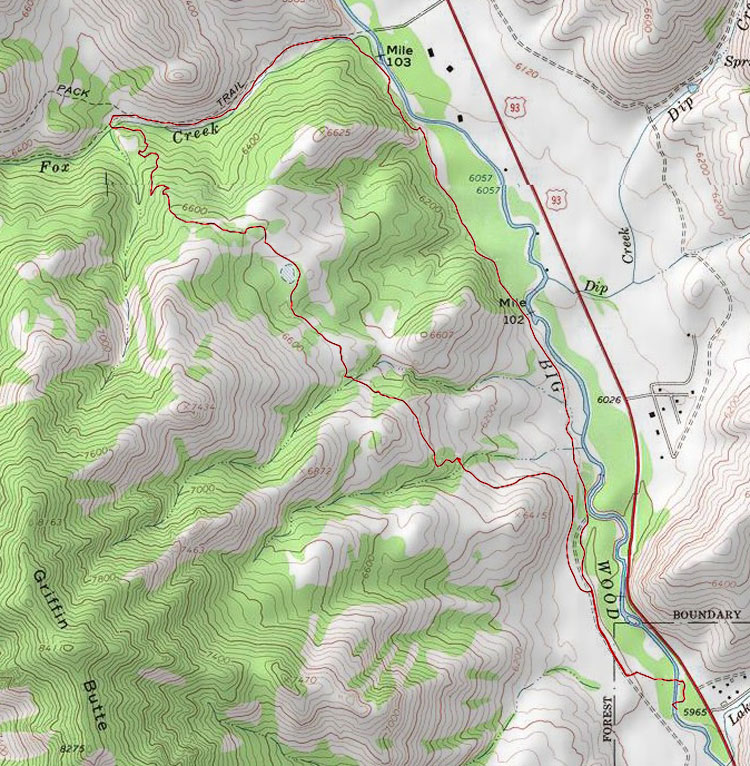
To reach the trailhead:
- » Take Highway 75 3.5 miles north from the Main St / Sun Valley Road light in Ketchum and park in the Lake Creek trailhead on the west (river) side of the road.
To ride counter-clockwise:
- » From the Lake Creek trailhead, cross the bridge and wind through the woods for 0.25 miles... you'll climb onto the bench and reach a two track road... turn right (north) on the two track.
- » Continue on the the two track. At ~0.55 miles you can either stay low on the river or bump up one bench... either way you'll be staying on the low side near the river on your way out.
- » Meander through the Aspens on a beautiful trail next to the river. At mile 2.15 hit a steep set of switchbacks and cross some shale before dropping back down to near river level.
- » At mile 2.55, cross Fox Creek on a bridge and turn left (west) at the trail intersection.
- » At mile 3.35 reach another trail intersection; turn left (south) at the intersection.
- » Climb up through the woods on some challenging switchbacks... keep moving to keep the bugs off you!
- » Top out at 4.1 miles and get ready for some great downhill with some great views.
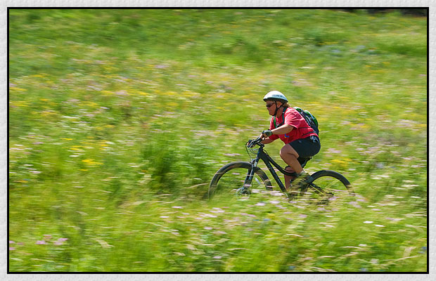
- » After riding through some great meadows (awesome wildflowers in season), start a great downhill at mile 5.15... be aware that while mountain bikers won't (shouldn't) be coming uphill hikers may be so stay alert and control your speed.
- » At mile 6.25 rejoin the two track you rode out on... retrace your path to the Lake Creek trailhead, making sure not to miss the left turn off the two track and back to the trailhead at mile 6.55.
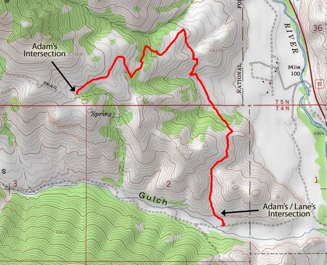
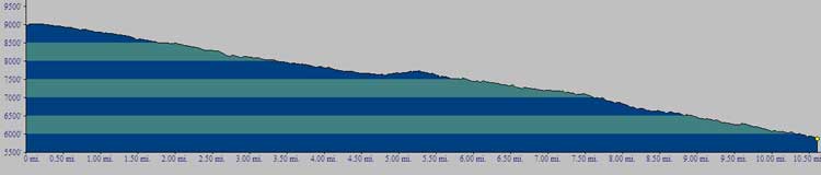
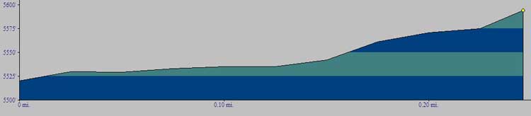
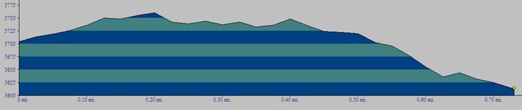
Alternate access point for Adam's Gulch, adds some length and a little less steepness to the Adam's Gulch loop. Ridden both up and down so please be courteous and share the trail. Profile below shows the downhill run of 1,200'.

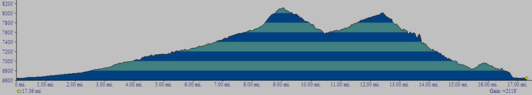
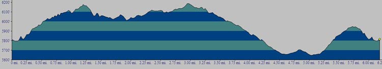
Fun big ride out Greenhorn Gulch, usually not rideable until mid June depending on how wet the spring was. Big climb of almost 2,000' earns you a great ride along the ridge with views north, south east and west. The climb up the gulch is almost all in the shade, and tops out at almost 7,500' so a good choice on hotter summer days. Route finding is pretty straightforward once you get headed up the correct draw. These are multi-use trails! Be respectful and dismount near horses, hikers and motorcyclists (yes, there are dirt bikers out here... they built these trails in the 70's so we could use them now, so be nice!)
To reach the trailhead:
- » Turn west at the Greenhorn / East Fork stop light (about 1/2 way between Hailey and Ketchum) heading out Greenhorn Gulch Road. Drive or ride 3.6 miles to the trailhead parking lot.
- » From the trailhead, start at the single track on the Northwest corner of the parking area (if you're standing looking north at the outhouse, trailhead is to your left, not your right). You can head down through the creek instead and meet up with the bench trail 0.4 miles later (which may make your mileage disagree with mine) but I prefer not to start the ride with wet feet.
- » Go up the switchbacks onto the bench and then drop right back down to the creek, reaching a small intersection at 0.43 miles... head SW from this intersection.
- » At mile 0.60 you'll pass a trail dropping in on your left but don't take it, this is where you'll end your ride. Keep heading WSW.
- » Whoa! At mile 1.25 is an intersection, you want to take the track leading off to the left (SW)... don't continue NW.
- » Climb, climb and then, err, climb some more. From here to the next turn is almost 1,100' vertical.
- » At mile 4.47 you'll reach a T intersection with some old lawn furniture to rest on (don't ask). Catch your breath then turn LEFT, heading due east.
- » Ride along the ridge, enjoying the views and the breeze... there are one or two "trail" signs to be watched for, so keep your eyes open.
- » Wend your way down the ridge and enjoy the downhill. At mile 8.0 you'll come to a fence line and an intersection... turn RIGHT (unless you want to head down two track back to Greenhorn Gulch road).
- » Climb another 0.7 miles up to a saddle with nice views, then cruise the single track back downhill.
- » At mile 9.3 you'll come to a T intersection you'll recognize from your ride up. Turn RIGHT to head back to the trailhead.
- » At the intersection at mile 9.7 you can either head left and go up and over the bench again to the trailhead, or head right and stay on the flats, ending with a cooling splash through the creek at the trailhead.
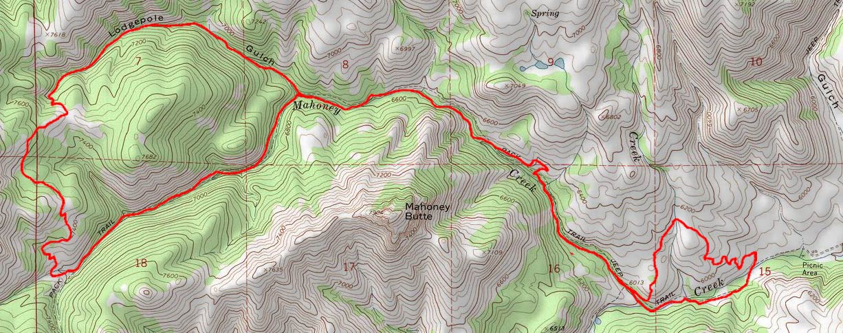
Another solid ride in the Greenhorn area. Similar in length and climb to Imperial Gulch, but more in the trees and so therefore a little more shaded of a ride (cooler in the summer, can be wetter than Imperial early and late). Relatively easy navigation, just make sure you don't end up in Red Warrior!
 Click here or on map above for larger map.
To reach the trailhead:
- » Turn west at the Greenhorn / East Fork stop light (about 1/2 way between Hailey and Ketchum) heading out Greenhorn Gulch Road. Drive or ride 3.6 miles to the trailhead parking lot.
To ride counter-clockwise (up Lodgepole, down Mahoney) starting by going up and over the bluff from the parking lot (as opposed to following the creek up) and coming down the creek at the end:
- » From the trailhead, go to your right at the west end of the parking lot and head up and over the small ridge... this is a slightly rocky climb, but it will get you warmed up!
- » Come back down off the ridge and intersect the main trail at ~1.25 miles... head Northwest.
- » At ~3.65 miles come to a split in the trail... if you want to ride clockwise, head Southwest (left) up Mahoney at the split... for this description we'll ride counter-clockwise, so turn right (Northwest) and continue climbing up Lodgepole.
- » Pass the right turn to Cow Creek trail... *DON'T TURN*, keep on the main trail.
- » Keep climbing, you're in the meat of it now. At mile 5.6 top out at a T intersection of the trail. A right turn will drop you into Red Warrior, so turn left to head toward Mahoney Creek.
- » Ride ~1 mile of some slightly technical up and down, come to another trail intersection... straight ahead ties (I believe) into Imperial, so turn left (ESE) and head down Mahoney Creek. You can let it run a bit through here but watch out for a few gravelly spots and a few narrow spots.
- » At about mile 8.3 tie back into the main trail, completing the "lollipop" part of your loop... turn right to head back down Mahoney Creek.
- » At mile 10.7 you'll see the familiar intersection you passed at the start of the ride... go left to head up and over the ridge again, or go right to continue down the creek and over some bridges and back to the trailhead.
Just like its cousin Cold Springs, this is an all grins downhill if you ride the chairlifts up, or a substantial out and back if you do the climb. This is a slightly steeper, slightly more technical ride than the Cold Springs side. This well used ride (with tourists and locals alike) is part of the lift served trail system Sun Valley Company created. Mileage is one way from the top of the chair lift to Apple's at the base of Warm Springs... if you didn't leave a car at on the Warm Springs side it's ~3.5 miles on the bike path back to the River Run base parking lot. Summer trail maps are available at both bases and make navigating easy.
To ride clockwise from top of the chairlifts:
- » Take the Broadway Trail 1.75 miles to the saddle below the Seattle Ridge Lodge.
- » Head WSW to the 2.35 mile mark where the trail splits right and left.
- » Take the RIGHT hand trail (heading due north) and enjoy the ride down.
- » From about mile 7.75 on there are some tight switch backs thrown in in some shaded areas, so stay alert.
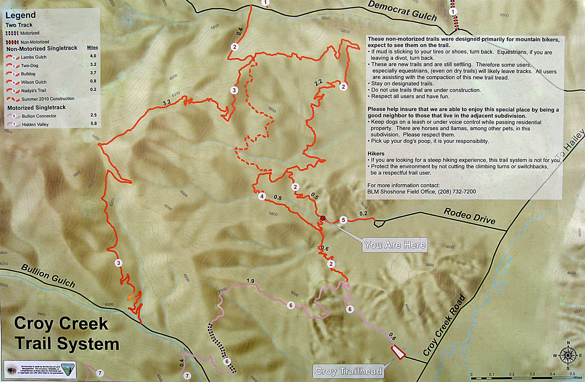
Is this cool or what?!? A whole new trail system right out Croy Canyon here in little old Hailey. Great riding, great views, very well maintainted trails, hard to ask for anything more. I'll try to describe them as I get to ride them, but they're all interconnected and you can do different loops in lots of different ways. Here's the trail map for the whole thing (click the map for a MUCH LARGER version of it:

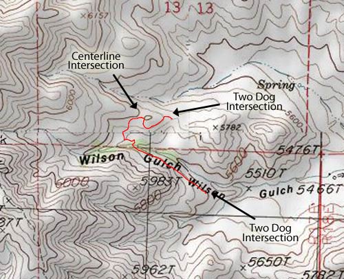
Bull Dog runs from its intersection with Two Dog (near Democrat Gulch) to its intersection with Bullion Gulch Road. Can be ridden both ways, this shows riding east to west (Two Dog to Bullion Gulch).
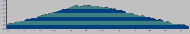
- » From Two Dog / Bull Dog intersection, continue heading southeast as you climb. Climbing is generally straightforward, with a few switchbacks thrown in.
- » At 1.25 miles from the Two Dog / Bull Dog intersection you'll reach the top of the climb.
- » A fun ~2 mile downhill brings you to Bullion Gulch Road.
- » You can either use the Bullion Connector to get back into the trail system, ride Hidden Valley, or head home on Bullion Gulch road and end up on Croy Creek Road.
Bullion Connector runs from the main Croy Trails trailhead (aka the BMX Track) up the motorcross track and then over to Bullion Gulch Road. From Bullion Gulch Road you can head uphill on the road 1/3 of a mile to the start of Bull Dog. Can be ridden both ways, this shows riding from the BMX Track to Bullion Gulch Road. Keep in mind this is a multi-use trail so be alert for motorcross traffic.
- » At the trailhead, follow the signs for the Bullion Connector and ride the single track climbing through the motocross track (keep your eyes open for people riding the motocross track).
- » At mile 0.6 you reach the intersection of Two Dog and the Bullion Connector... turn left, heading East.
- » Continue along the singletrack, climbing.
- » At mile 1.8 you will tie in to an old 4WD two track, heading left or SSE.
- » At mile 2.1 you'll see the singletrack branch off the two track to the right, heading west.
- » Continue another 0.6 miles down the singletrack until you run into Bullion Gulch Road.
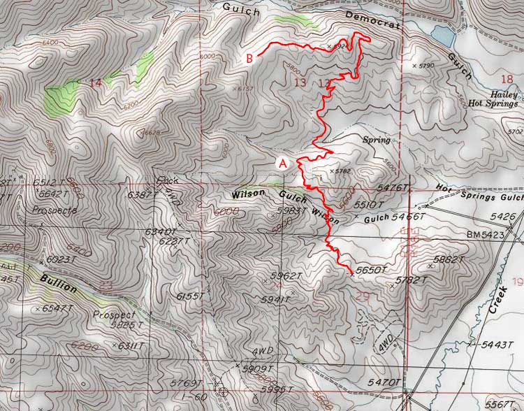
The newest trail in the Croy Creek trail system, Centerline opened in early fall of 2010. It's a short, 1.0 mile "freeystyle" trail connecting Two Dog and Wilson's Gulch. This trail has lots of features to allow jumps, drops, and other cool stuff that I can't do without hurting myself! While you can ride it either way, it's designed to be ridden North to South, as that's the way the features are set up. There are some narrow spots with some drop offs, so be alert.
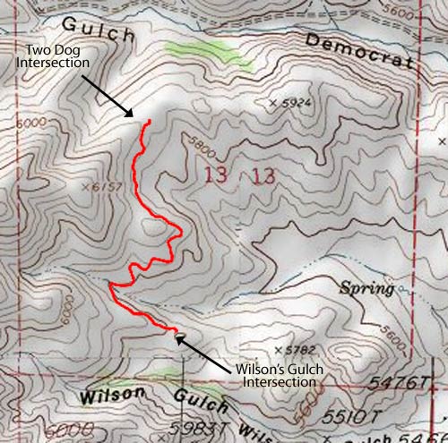
- » This one is pretty straightforward! Start at Two Dog (at the top of the connector that comes in from Democrat Gulch Road), and ride until you T into Wilson's.
Hidden Valley runs in a loop off of Bullion Gulch Road, a very scenic ride with one solid climb but otherwise good cross country cruising; it's also very easy to navigate. Generally ridden counter-clockwise, but be alert as people do ride it both ways. There is space for two vehicles right at the trailhead on Bullion Gulch Road, but if you're with a bigger group might be best to park at the main Croy Trails trailhead (aka the BMX Track) and ride over on the Bullion Connector. Keep in mind this is a multi-use trail so be alert for motorcross traffic.
- » From the trailhead, climb ~125' vertical over 0.4 miles, at which point you reach the first saddle where the loop begins... turn right to ride counter-clockwise.
- » Continue another 3 miles or so of rolling riding, some up and down, being alert for a few loose gravelly spots where the trail's a little narrow (i.e. don't slide off ;-) ).
- » At mile 3 you're at the high point, take a fun 1.5 mile downhill on some not too steep switchbacks down onto the valley floor.
- » After riding across the valley floor, it's a bit of a grunt 300' climb over 1/2 mile back up to the saddle (this climb gets very hot on summer afternoons, so be prepared).
- » Turn right at the intersection and ride the 0.4 miles back down to the trailhead.
Close to Hailey, lots of fun, great after work ride, very popular early and late season. Snakey during the hot summer months when it's best to head further north. Now (2010) tied into some new trails west of it that are definitely worth exploring. Most people ride this counter clockwise but be alert for clockwise riders.
This is the original trail of the Croy Trail System.
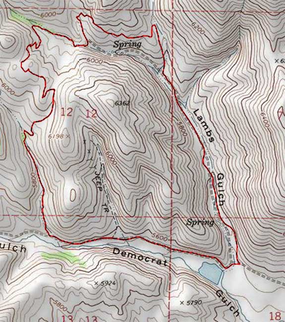
To reach the trailhead:
- » From the Bullion Street stoplight in the center of Hailey, head 1.7 miles west on Croy Creek Road and turn NW onto Democrat Gulch Road (dirt). Head 1.1 miles up Democrat Gulch Road to where the dirt road crosses a small creek, that's the trailhead proper.
To ride counter-clockwise:
- » Head NNE on the two track for ~1.1 miles.
- » At a fork in the two track, take the right (due N) single track and follow it in a small loop to the west (~ 0.8 miles) until you come down into a small draw where there is another trail split (1.91 miles from trailhead).
- » Take the right hand trail and start climbing again. 2.56 miles from the trailhead you'll reach the top of the climb.
- » Start your descent, watching for hikers and uphill bikers. At mile 3.72 the single track ends at a parking area that opens onto Democrat Road.
- » Ride Democrat downhill back to the trailhead, or back into town if you didn't drive.
If you're entering the trail system by riding up Rodeo Drive, you'll go the 0.2 miles up Nadya's trail to connect with the other parts of the trail system.
IMPORTANT: Please note if you're driving to this trailhead, parking is limited and you're better off driving to the main Croy Trailhead by the BMX Track (more parking, bathroom etc.). However, if you do park at this trailhead, please do so on the side of the road right near the trailhead (don't park at Rotarun, please), and be respectful of the residential area you're in (i.e. keep your clothes on, eh!).
To reach the trailhead:
- » From the Bullion Street stoplight in the center of Hailey, head 2.6 miles west on Croy Creek Road and turn W onto Rodeo Drive (paved).
- » Head 0.6 miles up Rodeo Drive to the trailhead on the right (north) side of the road as you get to the loop.
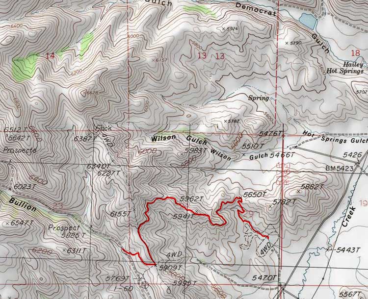
Two Dog branches off the Bullion Connector (0.6 miles up the hill from the main trailhead) and runs 3.3 miles to the connection with Bull Dog. At the Bull Dog connector you can either drops onto Democrat Gulch Road (another 0.4 miles) and head toward Lamb's or continue on to Bull Dog.
To reach the trailhead:
- » From the Bullion Street stoplight in the center of Hailey, head 3.5 miles west on Croy Creek Road and turn at the BMX track, proceed to the trailhead.
- » Head 0.6 miles up Rodeo Drive to the trailhead on the right (north) side of the road as you get to the loop.
- » From the trailhead climb 0.6 miles across the motocross track on the Bullion Connector.
- » At the intersection of the Bullion Connector and the start of Two Dog, take the right hand branch heading North.
- » At mile 1.0 you'll come to an intersection ("A" on map above), turn right (east).
- » Continue a rolling climb with good views and eventually you'll be looking down into Democrat Gulch.
- » At mile 3.2 ("B" on map above) you come to another intersection.
- » A right turn takes you another 0.4 miles down Two Dog to Democrat Gulch Road (not tracked on map above yet). Continuing straight takes you onto Bull Dog.
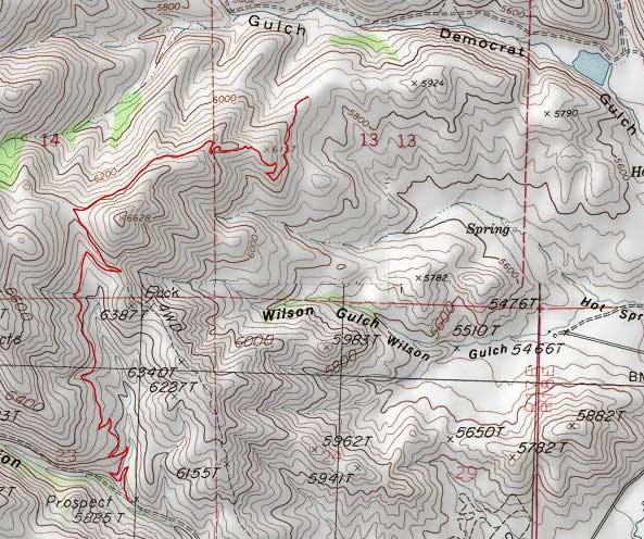
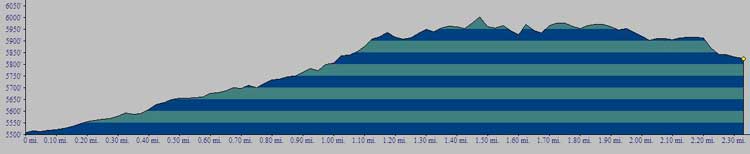
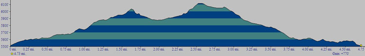
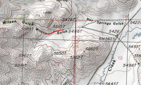
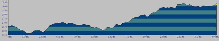
Wilson Gulch is a quick detour that can add a little variety to Two Dog and Centerline rides... a full, small loop of 1.25 miles can be made by riding Wilson's Gulch and a small portion of Two Dog. People ride both directions on Wilson's so be alert. Navigation is extremely easy. Profile below shows riding North to South.
|
 |